

Knowledge Base
May 2026
DigiFarm Contributes to European Commission Study on Automated Agricultural Parcel Delineation

Prepared by
DigiFarm Team
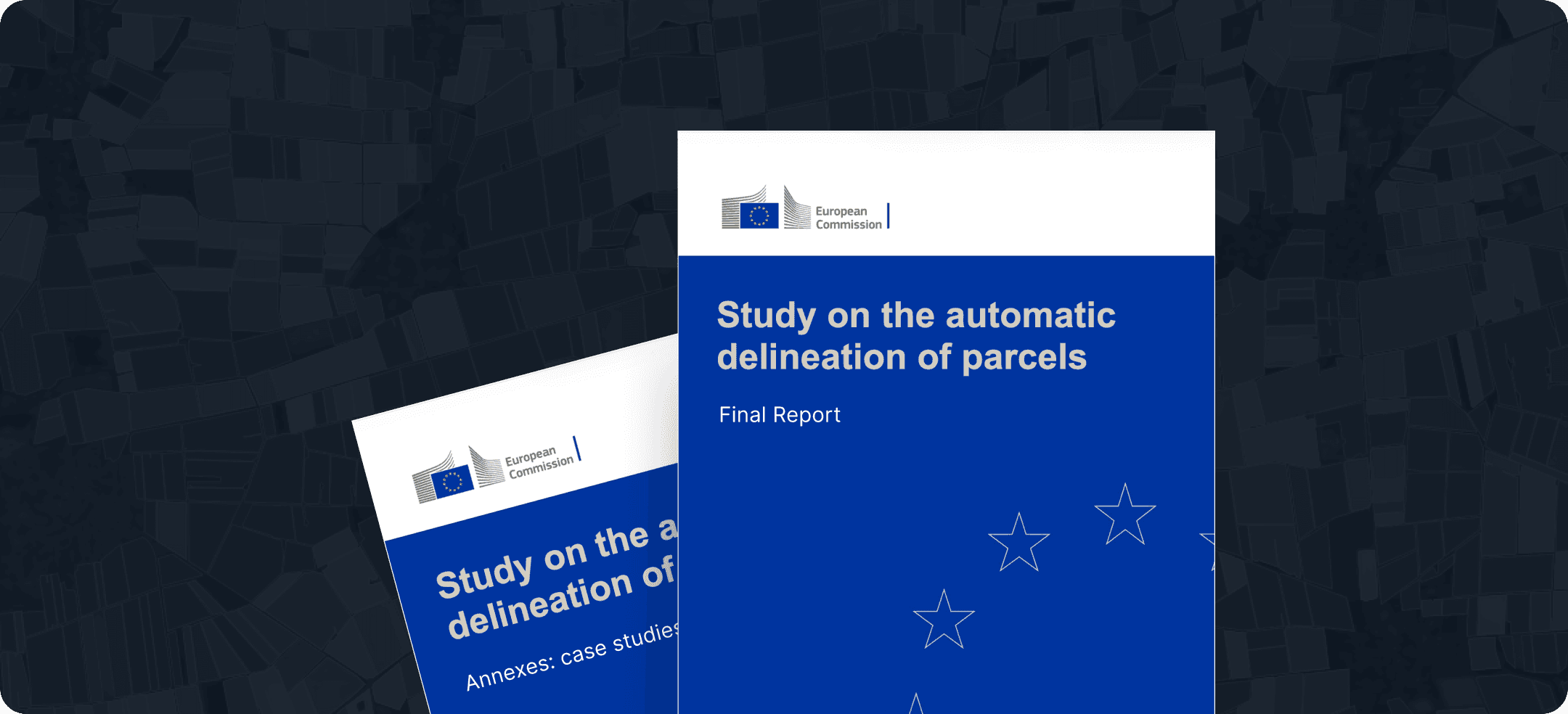
The study, coordinated by PwC Polska, assessed the readiness and effectiveness of automated parcel delineation technologies in operational CAP systems, including GSAA, LPIS, and IACS. Covering 43 technology providers and 21 Paying Agencies across Europe, the report provides one of the most comprehensive evaluations of Earth Observation-based delineation currently available.
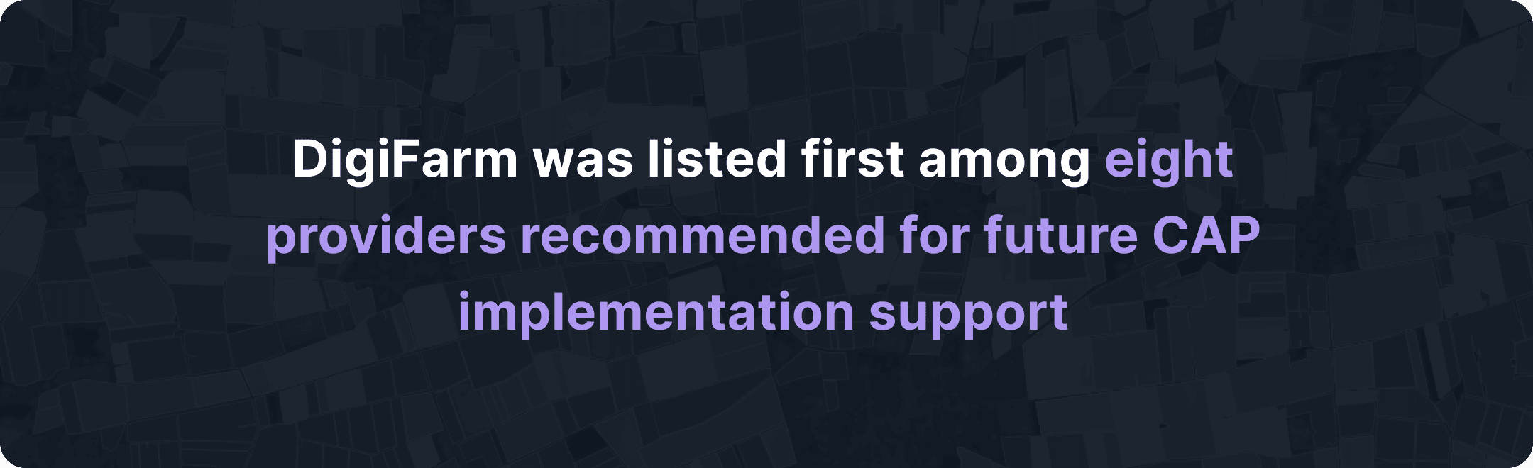
Over the past year, DigiFarm supported the research through expert interviews, technical consultations, documentation, and the provision of field boundary demo data. We are especially proud that DigiFarm was listed first among eight providers recommended for future CAP implementation support.
One of the study’s key conclusions is particularly significant for the industry: native Sentinel-2 imagery at 10m resolution was found insufficient for operational LPIS and GSAA applications. Instead, the report identifies AI-enhanced super-resolution imagery – reaching approximately 1m resolution – as the recommended pathway for reliable compliance and parcel delineation workflows.
The publication also highlights National Paying Agency under the Ministry of Agriculture, DigiFarm’s client since 2021, as the only fully operational national-scale automated delineation system currently deployed in the European Union. According to the study, the Lithuanian implementation achieved:
EUR 1.5 million in annual savings;
A 25% reduction in monitoring and control costs;
An estimated 2x return on investment on the service contract.
These outcomes demonstrate the real-world impact of scalable geospatial automation in agricultural administration and reinforce the growing importance of AI-driven Earth Observation technologies across Europe.
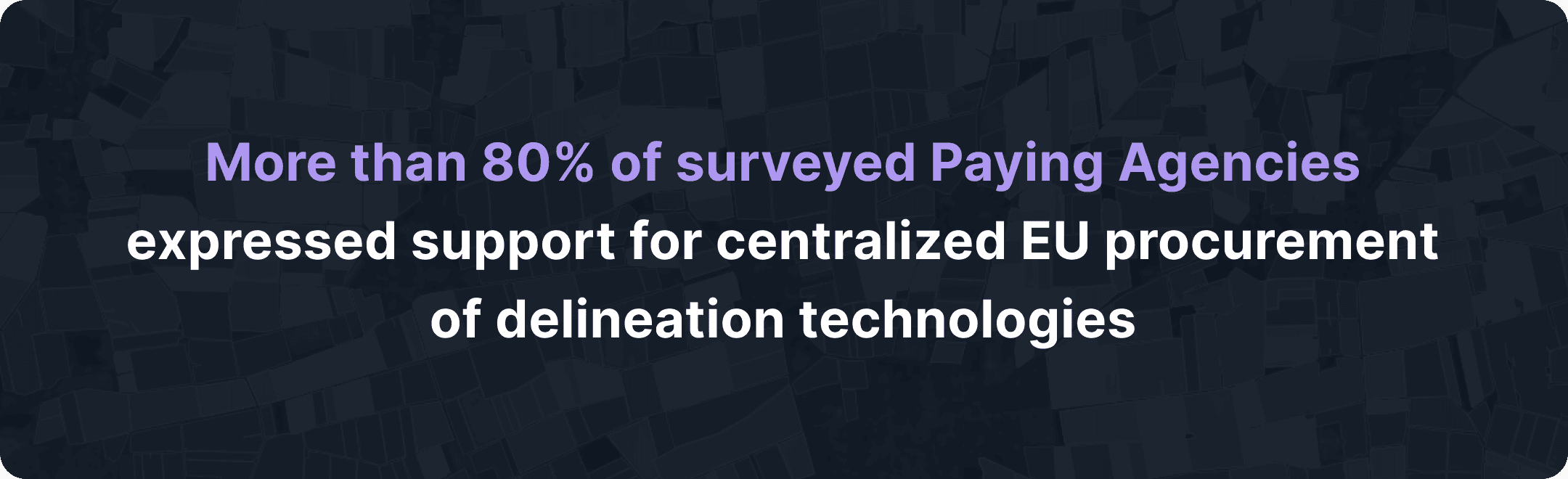
Another strong signal from the report is the market’s direction: more than 80% of surveyed Paying Agencies expressed support for centralized EU procurement of delineation technologies. This reflects increasing demand for standardized, interoperable, and cost-efficient solutions capable of supporting future CAP requirements at scale.
For DigiFarm, the study confirms both the maturity of our technology and the relevance of our long-term strategic direction. As agricultural systems continue to evolve toward greater automation, transparency, and efficiency, advanced geospatial intelligence will play a central role in supporting compliant and sustainable agricultural management across the EU.
Final report: https://op.europa.eu/en/publication-detail/-/publication/081c9514-394a-11f1-be39-01aa75ed71a1/language-en
Case studies: https://op.europa.eu/en/publication-detail/-/publication/fee2572b-394c-11f1-be39-01aa75ed71a1/language-en


Ready to revolutionize your business and take it to the next level?
Don't miss out on the latest AgTech solutions that can transform your operations and boost your profits. Contact our experts today to learn more about our cutting-edge products and services. Visit our website to explore pricing options and discover how we can help you stay ahead of the competition.


